Coastal Hazard Risk Management and Adaptation Plan (CHRMAP)

In conjunction with the State Government, and with the help of Baird Consultants, the Town of East Fremantle has developed a Coastal Hazard Risk Management and Adaptation Plan (CHRMAP) to identify key assets along the river foreshore and measures the Town will take to preserve them against the impact of coastal hazards. The final CHRMAP was endorsed in April 2024, subject to minor modifications.
A full copy of the CHRMAP can be found here ToEF Final CHRMAP
An extract of the Executive Summary can be found here ToEF CHRMAP Executive Summary
This project was also partially funded by the Western Australian Planning Commission through the Coastal Management Plan Assistance Program and the Department of Biodiversity, Conservation and Attractions.
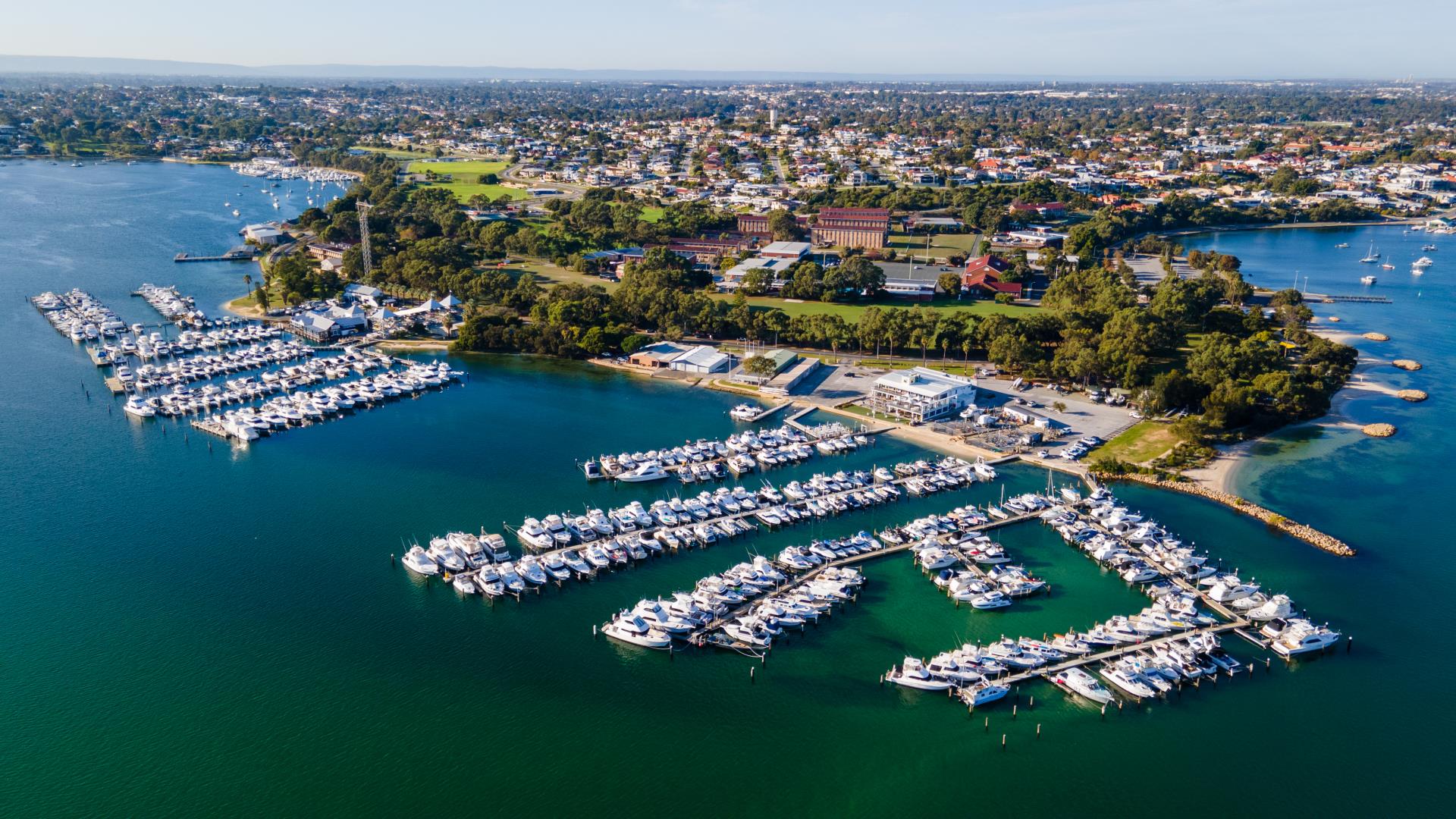
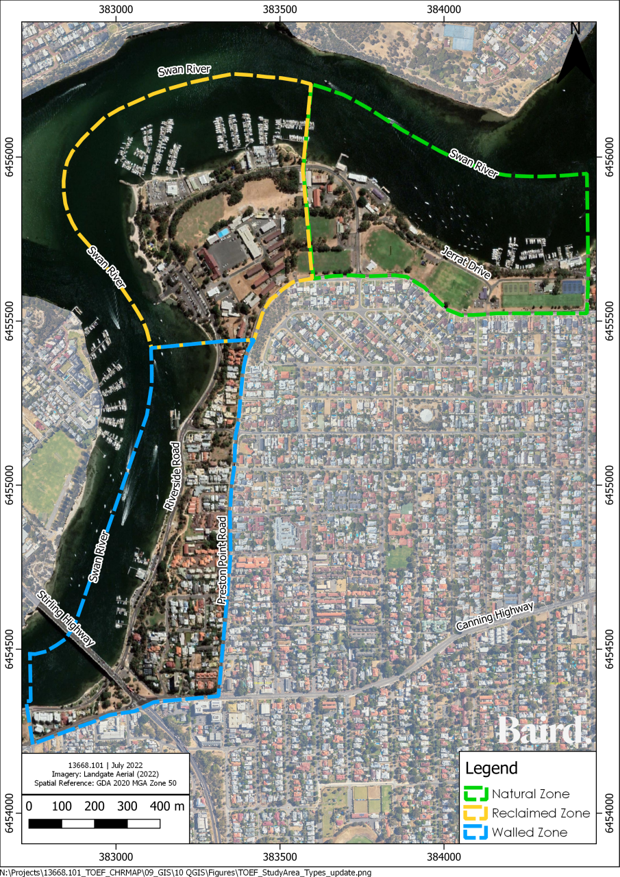
The study area for this project is located on Whadjuk Nyoongar land within of the Town of East Fremantle, some 3km of foreshore between Petra Street to the north-east and East Street to the south. The foreshore has interactions with many landmarks and recreational features including the John Tonkin Reserve, Swan Yacht Club, East Fremantle Yacht Club, several outdoor sporting grounds, hospitality venues and several boating moorings and jetties.
Click on below Project Area image to enlarge it.

East Fremantle Project Area
We are responding to climate change and coastal hazards
Through the recently endorsed Climate Emergency Strategy 2022-2032, the Town has acknowledged that we are living in a time of a Climate Emergency and need to urgently reduce or limit emissions to avoid potentially irreversible warming and environmental damage. Climate change, including rising sea levels, is predicted to increase the level of erosion of sandy coastlines and inundation (flooding) of low-lying areas, including the East Fremantle Foreshore
In recent years the foreshore has experienced an increase in flood events and inundation within the study area, further highlighting the need for the Town, alongside the community, to think deeply as to how to mitigate these hazards. These coastal assets, including recreational spaces, businesses and environmental assets, will face increased pressure in the future from the effects of human and environmental events.
Governments at all levels and private parties (individuals, businesses and the community) each have important, complementary and differentiated roles in managing risk arising from coastal hazards.

Riverside Road, East Fremantle 2021
Steering Committee and Community Business Reference Group
To help the Town guide the development of the CHRMAP, representatives from various State Government agencies have assisted. These include representatives from the Department of Planning, Lands and Heritage; Department of Biodiversity, Conservation and Attractions; and Department of Transport.
In addition, as part of the community and stakeholder engagement for the CHRMAP, a Community and Business Reference Group was established to help guide and provide advice around key milestones of the project and act as conduits between the community and the project team, helping to share important information and knowledge both ways.
Policy and Guidelines
The CHRMAP was prepared in accordance with the WA Coastal Zone Strategy, the State Planning Policy 2.6 – State Coastal Planning Policy (SPP2.6) and the CHRMAP Guidelines.
Details on the strategic and policy intent can be found at the following links.
WA Coastal Zone Strategy
State Coastal Planning Policy
Coastal Hazard Risk Management and Adaptation Planning Guidelines
Frequently Asked Questions (FAQs)
What is a Coastal Hazard Risk Management and Adaptation Plan (CHRMAP)?
A CHRMAP is a long-term plan to address the impact of coastal hazards on our coastline. It looks at various hazard scenarios within 25-, 50- and 100-year timeframes and, with input from the community and key stakeholders, identifies the most appropriate adaptation strategies and options.
What is a ‘coastal hazard?
When we say ‘coastal hazards’ we mean, naturally occurring events that impact our coastline, such as coastal erosion or flooding (also referred to as inundation).
Erosion is a process where parts of the shoreline are worn away due to waves, tides, wind or human activities. It can change the shape and form of the coast, reducing the area between the ocean and features on the land, and even allowing inundation
Inundation is when water occupies previously dry land. It can be temporary or permanent.
Permanent inundation refers to the loss of land due to sea level rise.
Temporary inundation is the flooding of an area due to storm surge, high tides, large waves or heavy rainfall.
What might be the strategies and options for managing coastal hazards?
There are four overarching ‘strategies’ to manage coastal hazards. These are:
|
Avoid (erosion and inundation)
identify ‘non-build’ area for the future
|
Managed Retreat (for erosion)
withdraw, relocate or abandon assets at risk
|
|
Accommodate (for inundation)
continue to use the land but accommodate changes by building on piles or converting land use
|
Protect (erosion and inundation)
use hard or soft solutions to protect land from the sea / river
|
Within the strategies chosen, the CHRMAP can further specify options to manage coastal hazards. These include, but are not limited to:
- Building Design
- Planning Controls
- Engineered Structures (eg seawalls, groynes, breakwaters, Revetments)
- Nature Based Solutions (eg beach nourishment, planting)
As someone who lives, works and/or recreates in East Fremantle, how could the outcomes of the CHRMAP affect me?
The inherent nature of a CHRMAP is to look ahead several decades into the future, making it a bit more difficult to image the tangible outcomes of the Plan. However, it is likely that you or someone you know uses assets along the foreshore now that represent some sort of environmental, economic or social importance to the fabric of the East Fremantle community and beyond.
While this is a strategic, long-term plan for managing coastal hazards on the coastline, it is important for the community and key stakeholders to be involved so that the plan accurately reflects their values and aspirations for what is important along the coastline.
For instance, you may currently use a walking path close to the river linking you to businesses and points of interest along the river. How would you feel or how would you be impacted if this path was affected by erosion and inundation? Is it important for this type of asset to remain for the next generation to use and enjoy?
It is also essential that you get involved as we ask the community and key stakeholders for their input on preferred management options – that is – what can we do to manage the risk from erosion and flooding?
Is this project related to the proposed tree planting along the foreshore?
No, this project funded by the Town is a separate project running adjacent to the CHRMAP project and objectives.
Who is funded the preparation of the CHRMAP?
Funding for the preparation of the CHRMAP was jointly funded by the Town and State Government.
I don’t feel that climate change is real or could impact me, therefore I don’t understand why the Town is investing in a CHRMAP.
Regardless of whether you believe climate change to be real or not, the river shorelines and the assets that are situated along them are currently experiencing impacts from coastal hazard through erosion and /or flooding.
The CHRMAP will look at the present day coastal hazard risk and provide guidance to the Town on how it can manage the risk today and in future should the risk increase due to climate change (eg sea level rise, more severe storm events)
The Town is strongly in support of recognising the Climate Crisis and taking action to reduce its impacts.
Are there examples of other CHRMAPs that I can look at?
There are many examples and these can be found here